
I have been holding a winning lottery ticket for years, and I had no idea. That is how I felt last week when I finally got around to driving the first 70 miles of the Denali Highway in interior Alaska. I have been spending the summer in Alaska for 10 years and yet had never been past mile 18, even though the road begins a mere 20 miles from my house. I’d been missing out.
I don’t want you to suffer the same fate. If you ever find yourself in Alaska, you must make this drive. I am going to give you a virtual tour of the first half of the road, from Cantwell to the Susitna River bridge, so that you will hopefully be inspired to go. This photo tour will be in black and white, so that you will feel a sense of nostalgia for a place you’ve never been.
Denali Highway Photo Tour
Note: miles are listed from Cantwell on the west end of the road.
 Mile 4.5 to 11 – Denali Views
Shortly after turning onto the Denali Highway, you can get views of the highest peak in North America. The mountain rises four miles into the sky and is the highest mountain from base to summit in the world. It is truly spectacular and seeing it never gets old.

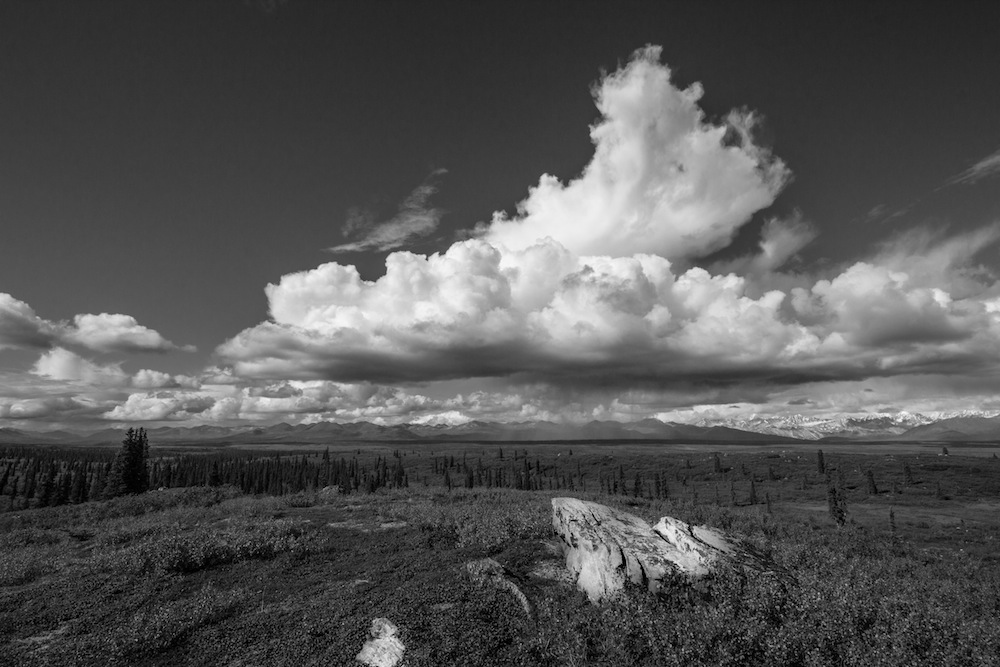
Mile 8 – Photogenic Lake
There are lakes and ponds all along the Denali Highway, but the large lake eight miles in is the first stunner. Backed by polychromatic mountains and frequented by local fishermen, this is one of my favorite spots.

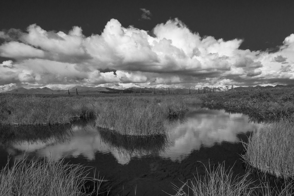
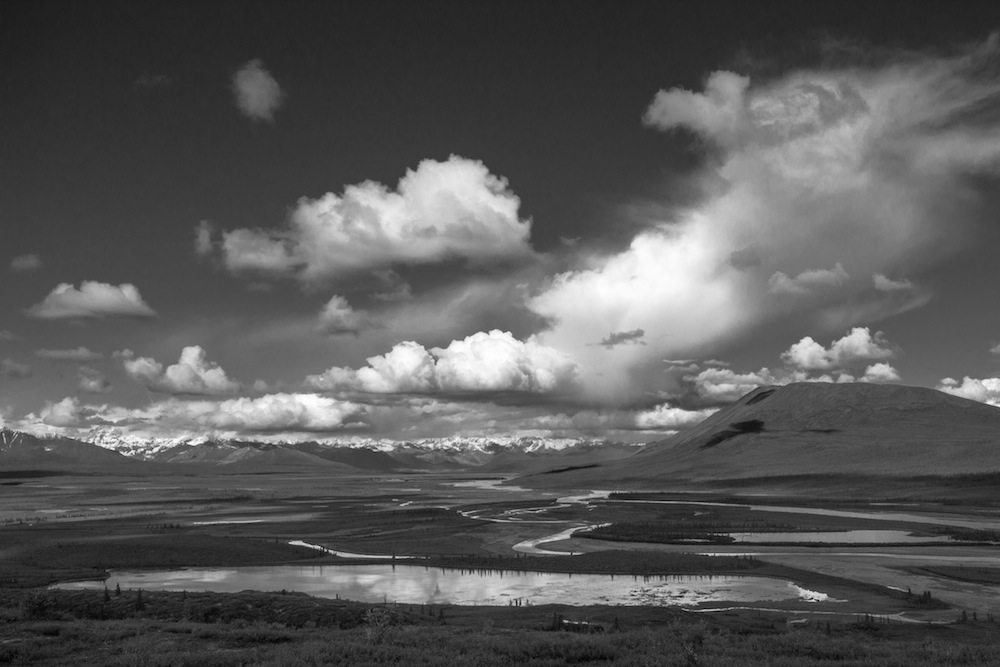
Mile 10 – Marshland
Ten miles down the road, there is a marshy area frequented by ducks, geese, otters and trumpeter swans. This is also the area where I almost got shot because I rode my bike down a side trail past a no trespassing sign. That is a mistake I will never make again.

Mile 18 – Nenana River
At mile 18, the road pulls up to the Nenana River and then climbs a hill high above the river lands. This is a frustrating area for a photographer because there are no great view points – most photo ops are obscured by brush or trees. Although hard to take a photo, the views are still great.

Mile 30 – Brushkana River
After driving through taiga for about 12 miles, the road reaches the Brushkana River and campground. This is a great spot for fly fishing, hiking or to take a break from the road with a picnic.

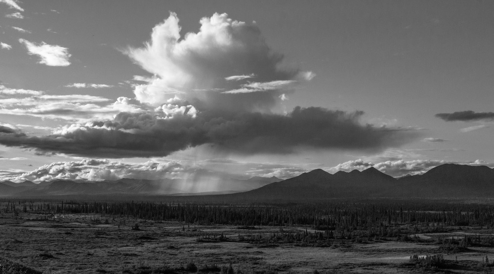
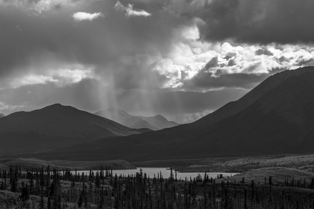
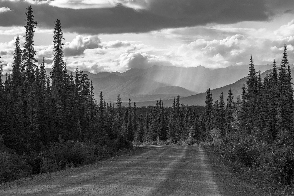
Miles 30 – 49.5 – Awesomeness
For the next 15 miles, the road travels atop a ridge and offers spectacular views of the mighty Alaska Range across the tundra. In this area, there are numerous lakes and pullouts which make great places to take photos or take a break.

Mile 49.5 – Alaska Range Viewpoint
On the north side of the road is an unmarked trailhead that after a moderate, 1/4 mile hike offers sweeping 360-degree views of mountains, glaciers, the Susitna River and dozens of mountain lakes. Note: you may want some insect repellent. The mosquitoes have been waiting patiently for you.
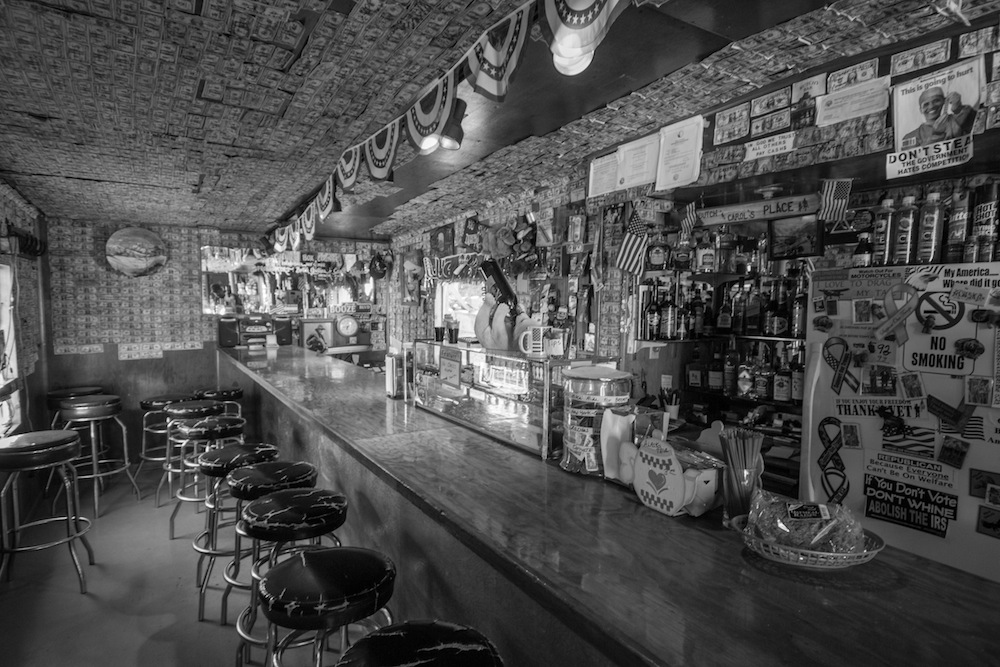
Mile 52 – Gracious House
After fifty-miles of wilderness, suddenly there is a tiny bit of civilization at the Gracious House Lodge. They have pies, hamburgers, espresso and beer. Note: there is a lot of libertarian propaganda in the bar, which makes sense, because it is the Middle of Nowhere, Alaska. Obama would not feel welcome.

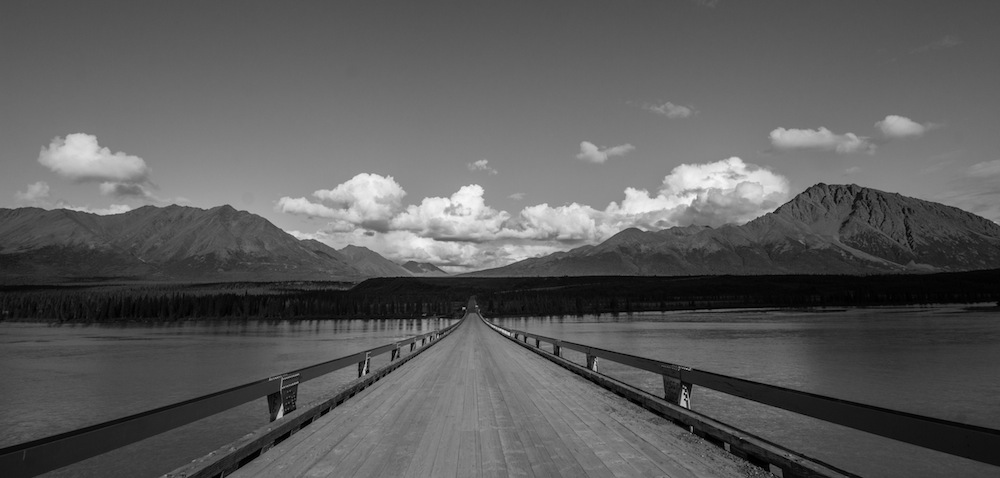
Mile 55.5 – The Susitna River
I read once that thousands of bridges in America are vulnerable to collapse. I thought about this midway across the precarious looking Susitna River bridge. The bridge, which is closed over half the year and resides halfway down a forgotten Alaskan highway, probably doesn’t get the attention it deserves.
Aside from the totally rational fear of bridge collapse, this area is really beautiful and is one of the highlights of the drive. A friendly local told me that caribou can be seen swimming across the river during migration season. Now that would be cool to see!
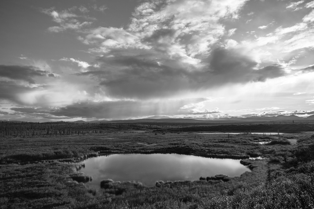
Miles 60 – 70 – More Awesome Views
At this point, I stopped and ate my lunch on the side of the road and took in the awesome views back towards the Susitna River. The road passes several large lakes, then climbs up to offer sweeping vistas of the mountains to the south. It was an appropriate spot for me to turn around – it had taken me over four hours to drive to that point, but I knew right away I’d be back as soon as possible.
Notes
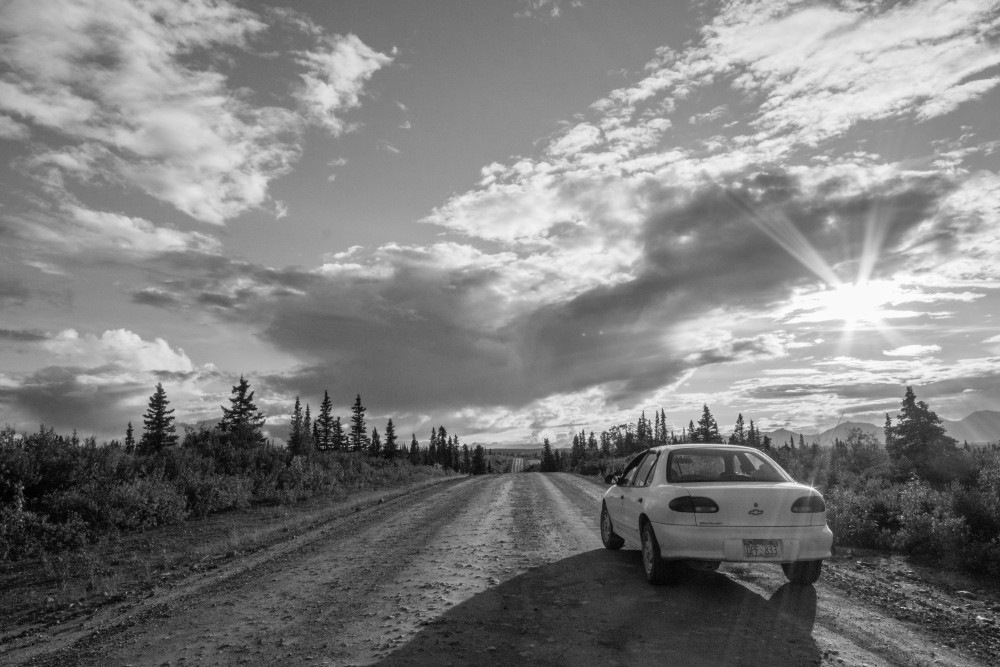
Highway is a generous term for the 135 mile stretch of road. It consists mainly of hard-packed earth, potholes and washboard, kind of like my abs. It is a rough drive and in a small car like mine, (featured above – I know you are jealous of my awesome car) it is only possible to go between 25 – 45 mph. It is a slow go, but worth it.
Before you drive, download the map from the Bureau of Land Management which operates several of the parks along the road.
The road is closed during the winter, reopening sometime in May. There are a few lodges on the road, but you should prepare to be self-sufficient. Absolutely make sure you have a spare tire and full camera batteries.
And whatever you do, don’t go down a side road with a sign that says “No Trespassing.” Trust me on that one.
______________________________________
Have you ever been down the Denali Highway?
What is the most spectacular road you’ve driven?
______________________________________


Absolutely gorgeous Jeff. I will say however that the link to your post via the no trespassing sign is enough to scare anyone off traveling forever. Yikes that is a truckload of experiences!
There is a lot of public land and a lot private land on this road, so I am VERY careful to make sure where I am at now! I really thought I was going to get shot.
Oh my goodness Jeff be careful. I tend to get myself in trouble looking for photos but have never had a gun pointed at me. Gulp!
So glad you finally made it (most of the way) down that road. Now do you see why I spent so many weekends there?
I always wished I could take a 30 foot ladder on top of my car to use to get some great shots of the Nenana river when the road goes up that first big climb. You can see that the views are indeed spectacular, which makes all the trees that block the view so frustrating.
And the berries along the highway…….
We just got back from driving all the way. Day 1 we drove through fog and a constant, relentless downpour. Today, driving back, we had mostly cloudy but is was spectacular. I really like the area by the MacLaren River. I do see why you went there so often – it rivals the park road for sure.
That must have been a fun drive in a downpour. Yuck.
I always preferred the views on the Denali Highway, but the park road is definitely a lot better for wildlife.
Make sure you go again!
Agreed about the wildlife. We saw a bald eagle, a caribou running from a hunter and a few swans. 270 miles worth of park road would have produced dozens of bears, caribou and Dall sheep for sure, not to mention moose, but I can see those from my cabin 🙂
Wow and wow! Oh- I can’t wait for our trip. I’m glad you made the trip and shared it with us!
It is a really special place, rivaling that of the road in nearby Denali National Park.
~ WOW!!!
Really beautiful Jeff. The black and white treatment is the perfect touch – truly love the swans. I think you give Ansel Adams a run for his money. And as for the No Trespassing – learned that years ago in rural Kentucky. No means No. 🙂 ~Terri
Rural Kentucky and rural Alaska are two places we should no doubt obey No Trespassing signs. Can you tell your story?
love it
Beautiful pictures, brings back memories (mine are with colour though..) Agree with the highway statement, can still feel the pain after hours and hours bumping and sliding on the somewhat uncomfortable bus seats. But it was absolutely worth it!!
We took our car down it last year and our glove box latch broke. It is still broken. The road rattled our car to death, but it was stunning, so worth it!
I can believe that for sure:)