

My home state of Oklahoma sits at the southern end of the Great Plains, bridging the Midwest, Southeast, and the Southwest while resting atop Texas as a cozy hat. When people who have never visited ask me to describe my home state, I find it difficult because it is strangely diverse. Although it is primarily a flat state, the east side features the forested Ozark Plateau and the Ouachita Mountains, remnants of an enormous range that included the Appalachians. The western side of the state has mesas, badlands, salt plains, sand dunes, granite mountains, and ancient lava flows that wouldn’t be out of place in Utah, Colorado, or Nevada.
The geographic diversity of Oklahoma makes sense when you think of it this way – it is roughly the same size as Syria, Uruguay, or Cambodia. It would be the 86th-ranked county in the world for size if it were an independent nation. It is simply arbitrary lines on the Earth, but within those lines, are seven geographic oddities I find fascinating.
7 Interesting Geographic Areas in Oklahoma
1. Gloss Mountains
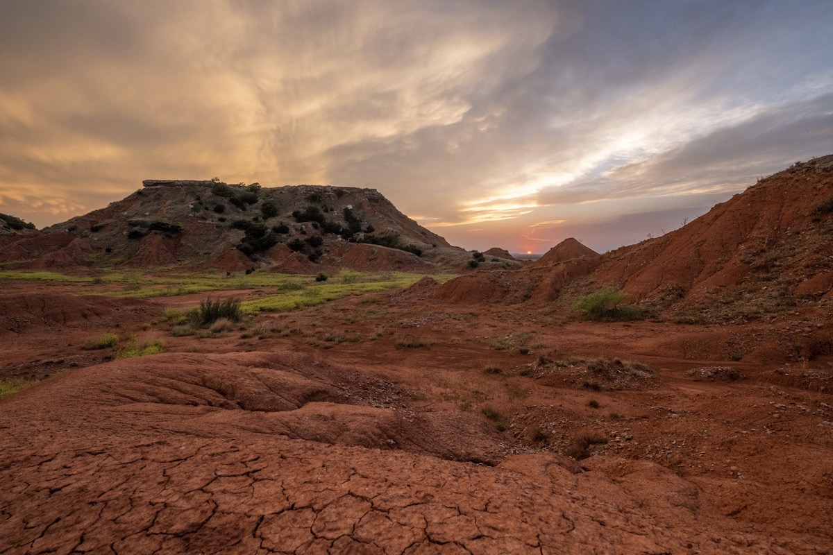
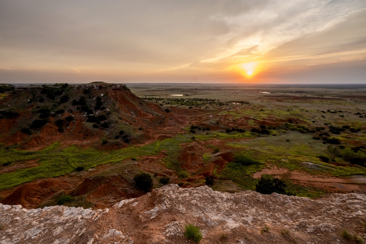

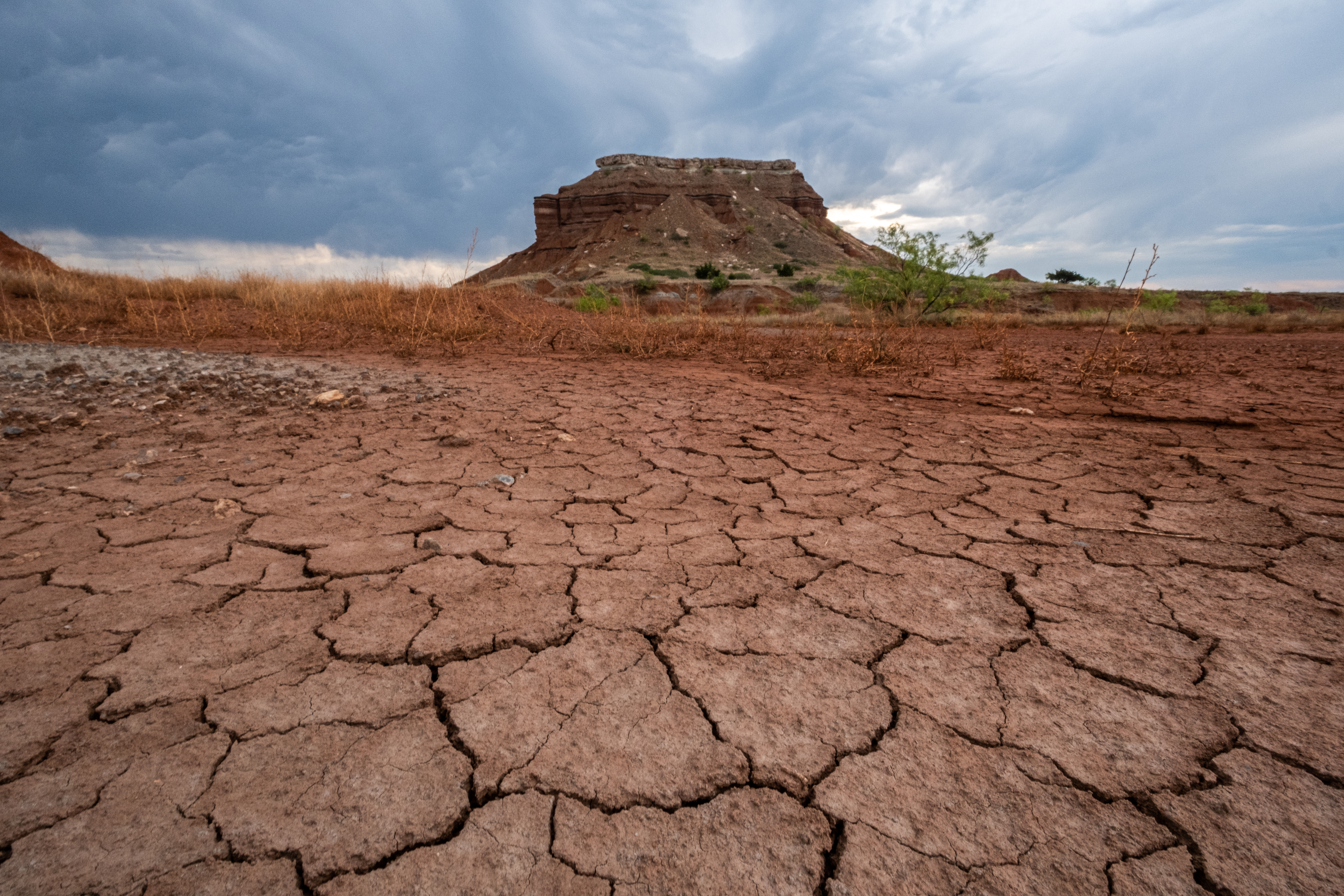
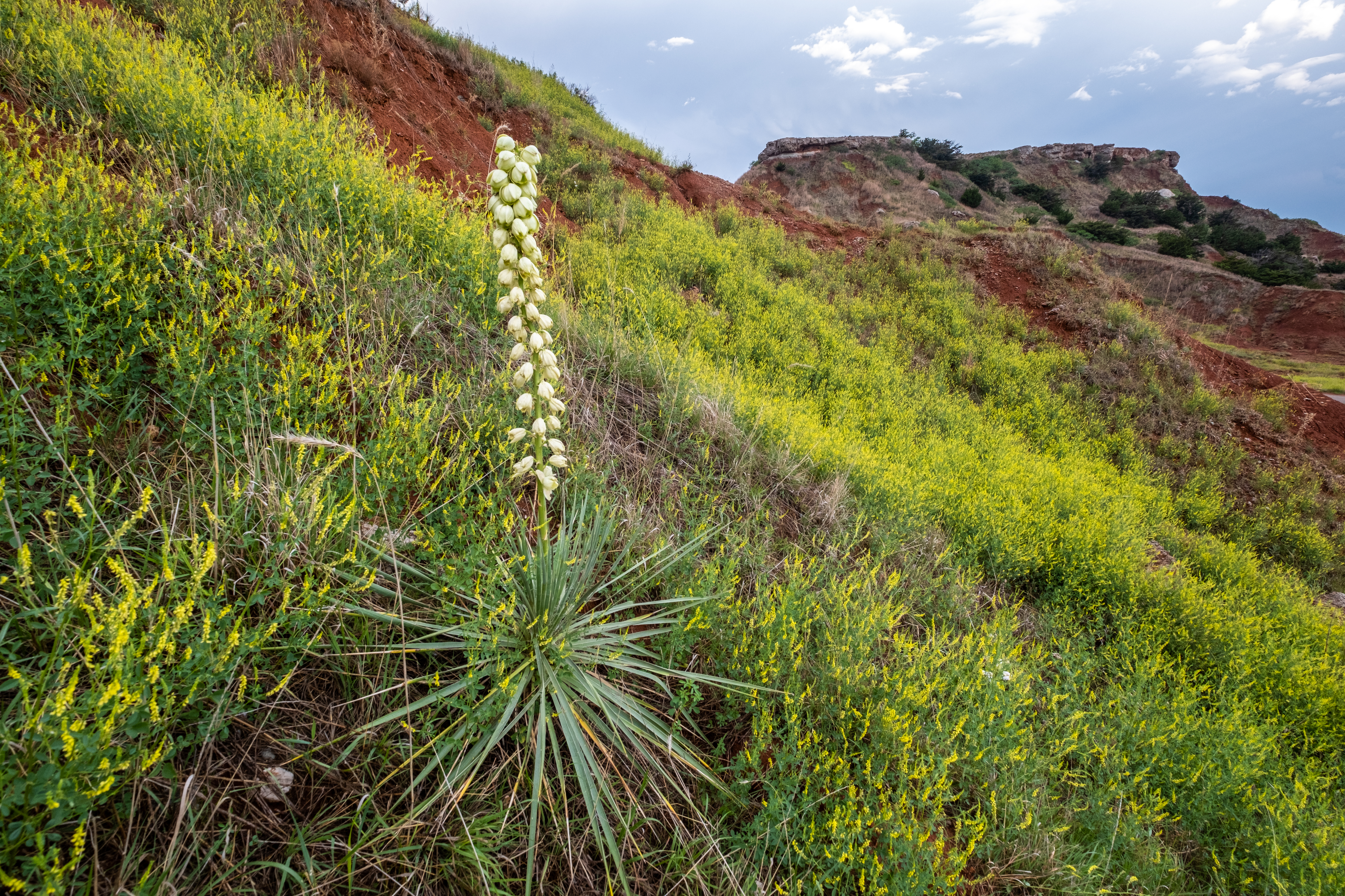
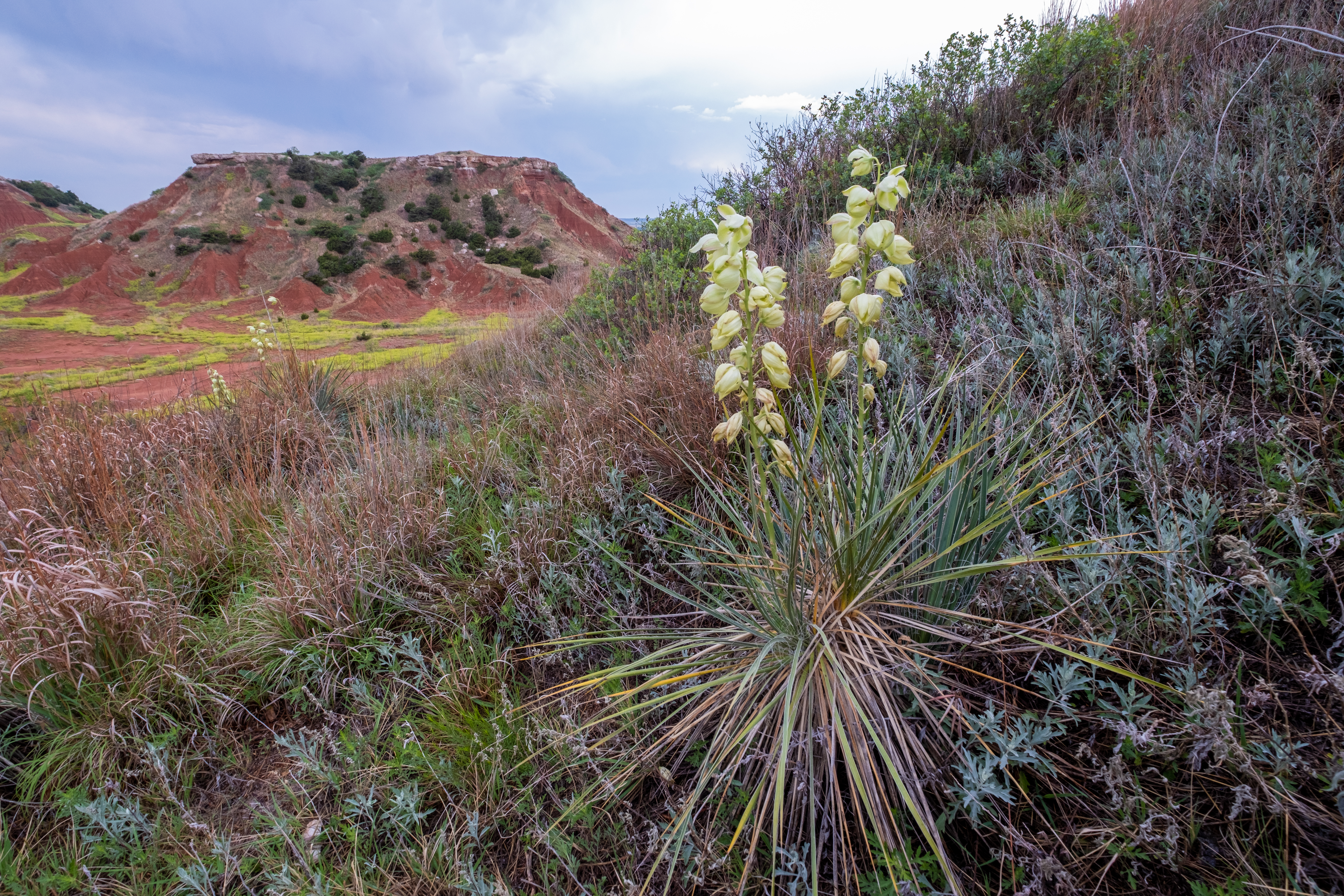
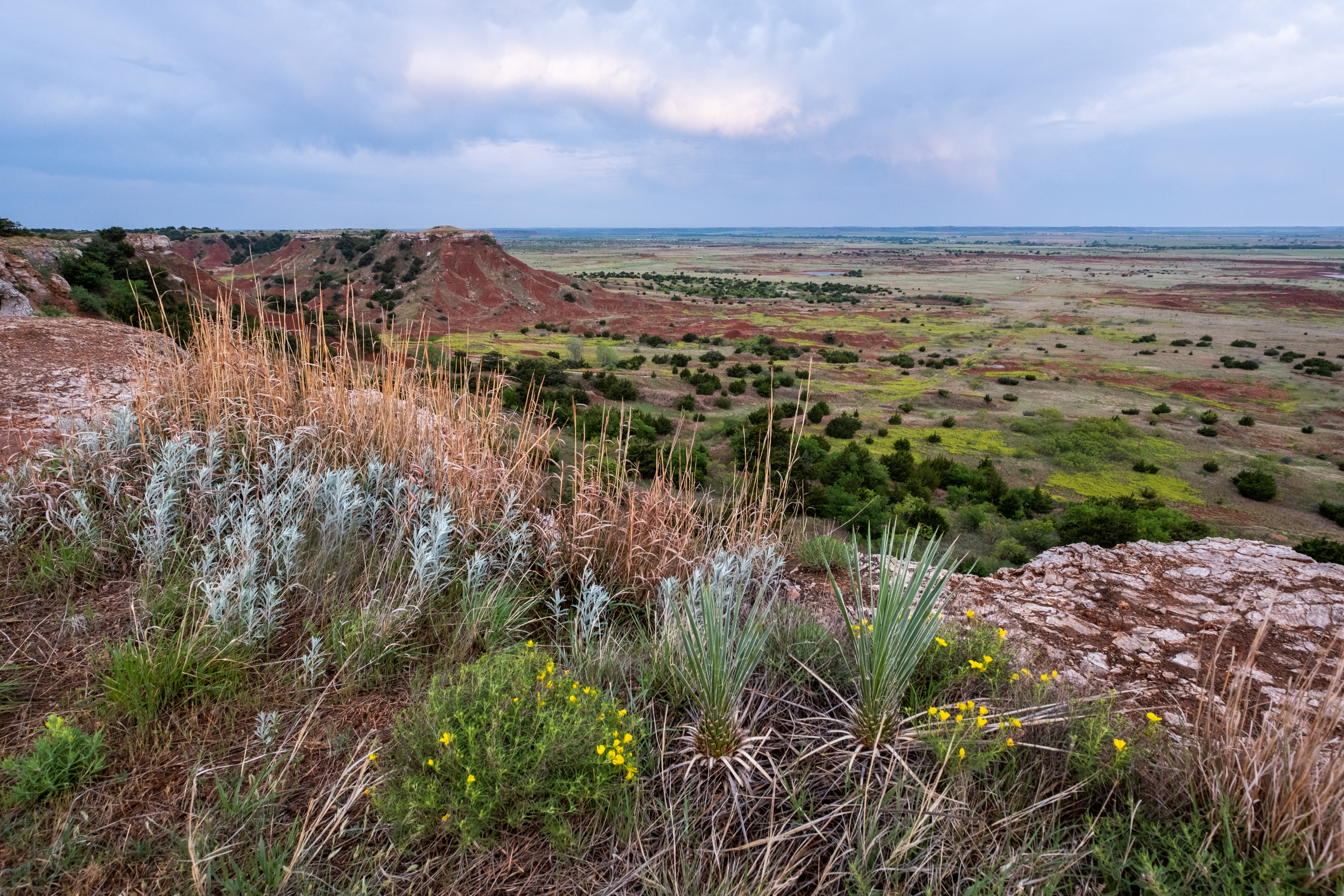
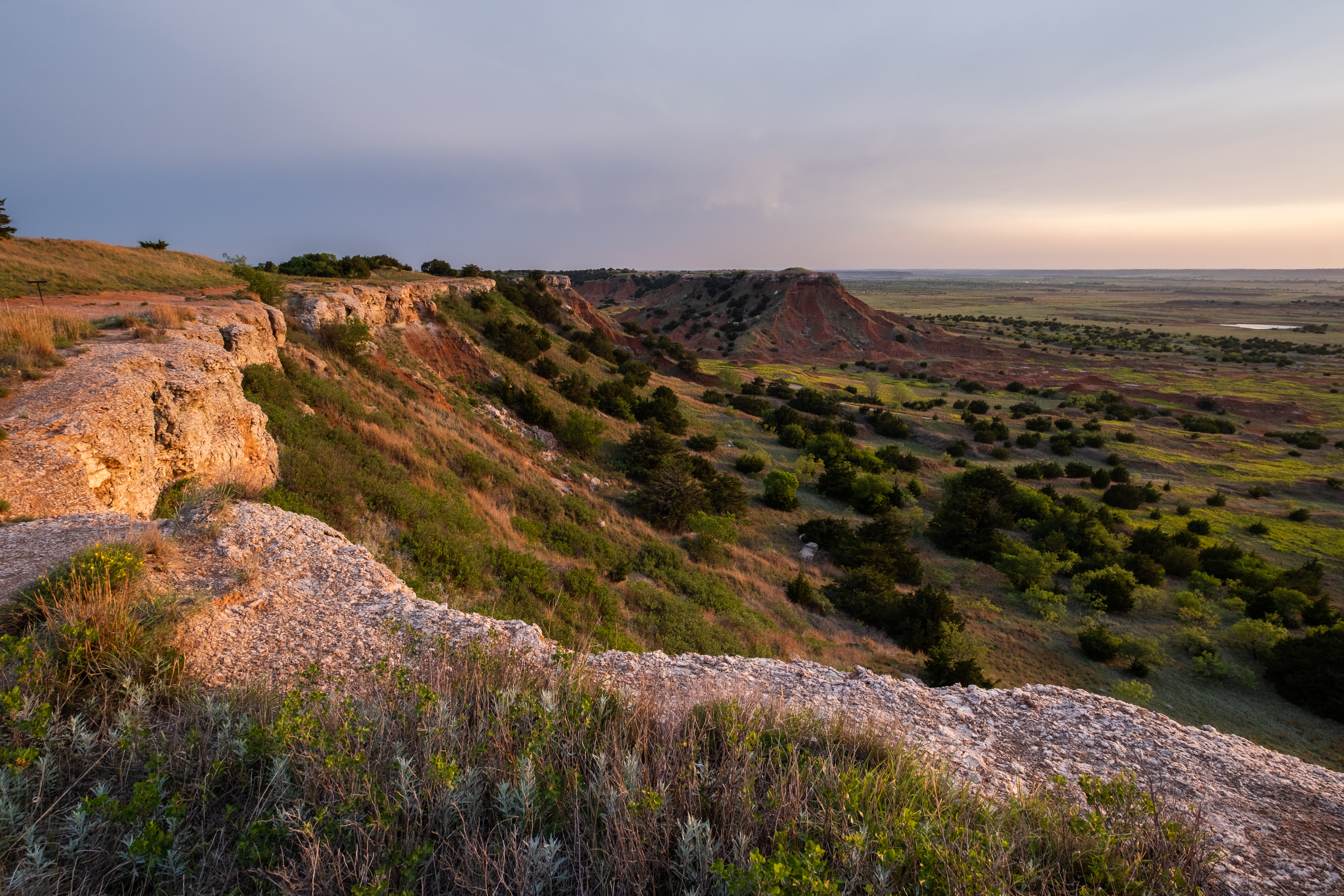
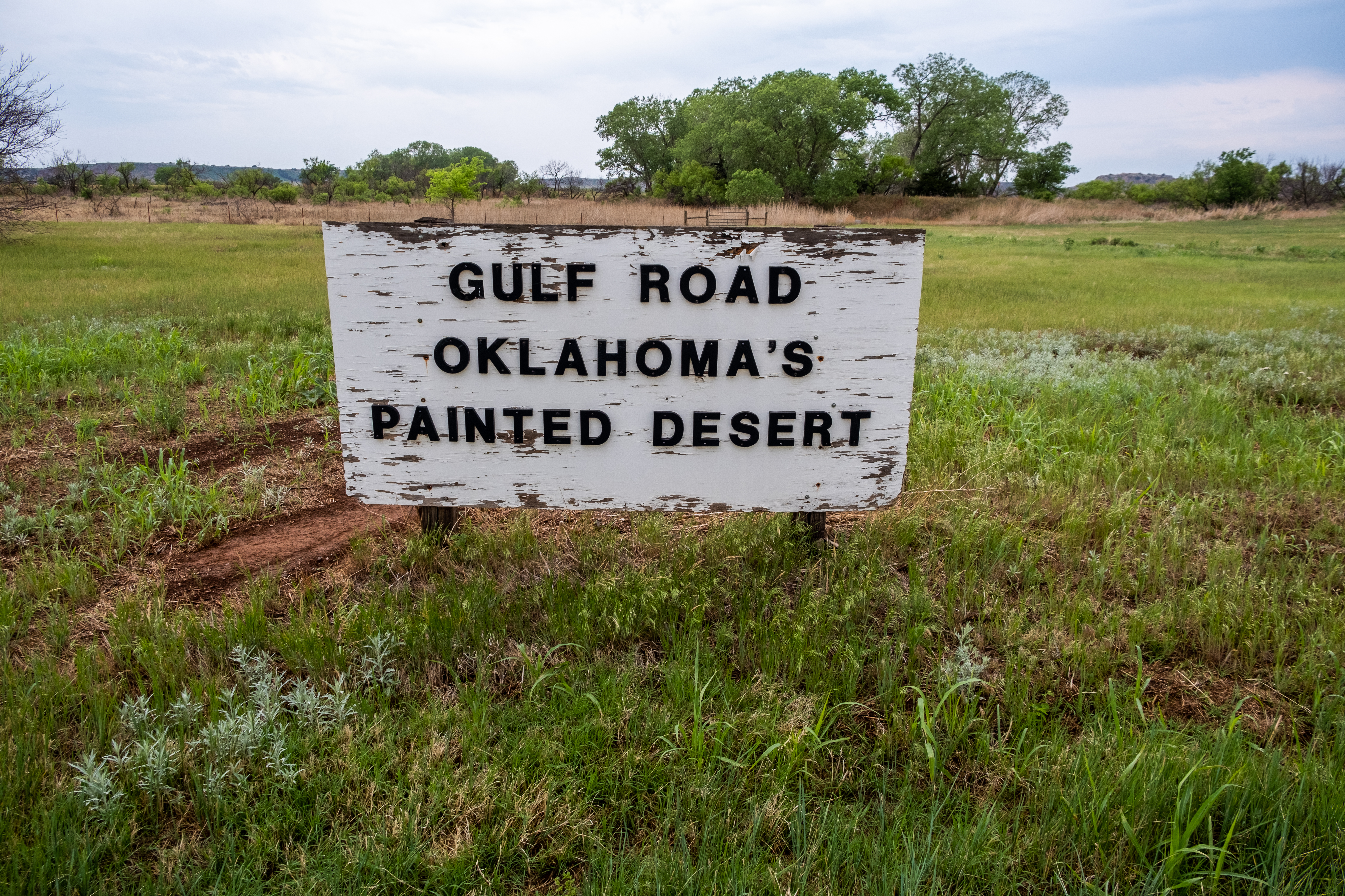
I have always loved driving through the gypsum-capped mesas and rust-colored badlands of the Gloss Mountains. When you live in rural Oklahoma, you must drive a considerable distance to get anywhere and the Martian landscape broke up the monotony of the trips.
This area, which stretches for about 70 miles from Freedom to Orienta and was once part of a vast inland sea, looks like it belongs in Utah. There is a small state park on the east end of the land feature, where visitors can climb to the top of a mesa and enjoy 360-degree views of the landscape.
2. Wichita Mountains
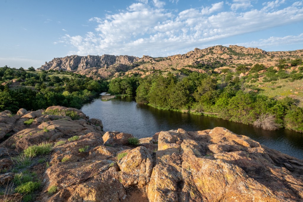
If the Gloss Mountains are a bit of Utah in Oklahoma, the Wichita Mountains are a breakaway republic of Colorado on the plains. The rocky peaks of the Wichitas first appear as a mirage as they rise incongruously out of the flat farmland. The area has two state parks and the spectacular Wichita Mountains National Wildlife Refuge with hiking trails, fishing holes, and scenic drives that wouldn’t be out of place in the national park system.
My last post was about the Wichita’s, so click here to see a story and photo collection.
3. Little Sahara Sand Dunes
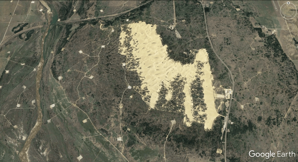
On the edge of the Gloss Mountains, just north of the Cimmaron River, lies the Little Sahara Sand Dunes.
Although there are many stretches of sandy soil in the area, this is the only place with legit dunes. The Cimmaron River covered the entire area in the past, and sand from the ancient river banks formed the dunes. Sadly, at least for me, the park is not a place I can explore as it is the domain of noisy dune buggies. Maybe next time, I’ll embrace the chaos and drink beer with the ATV enthusiasts who converge on the park on the weekends and holidays.
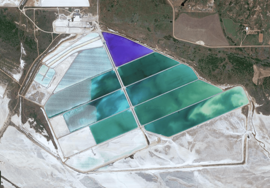
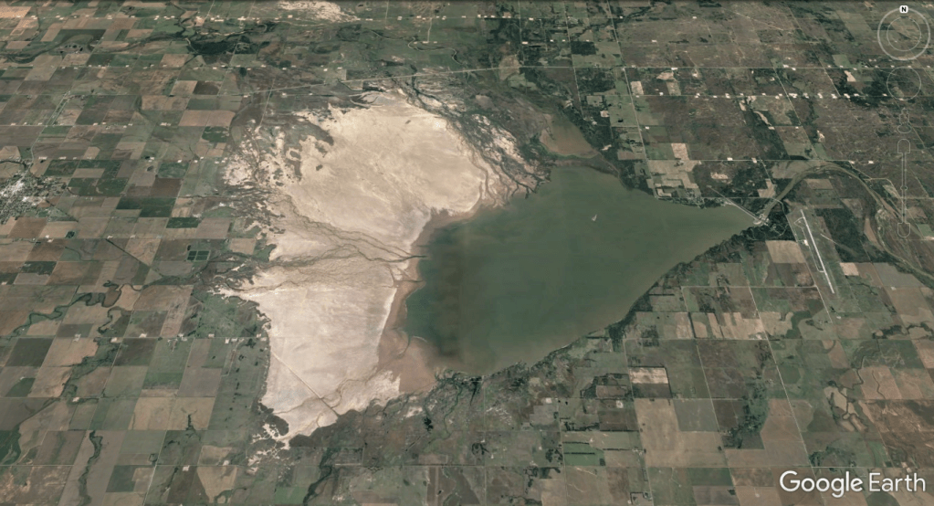
4. Great Salt Plains
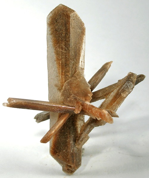
Remember how we said northwest Oklahoma was once an inland sea? Good, glad you were paying attention because that fact is relevant here. When the inland ocean receded for good, it left behind a thick crust of salt. The remnants of that salty sea crust form the 17-square mile salt plains in Northwest Oklahoma, protected by a state park and national wildlife refuge. Saline-rich groundwater still flows beneath the surface, replenishing the salt plains during floods. The salt plains were an essential stop for nomadic Native Americans who used the salt to preserve meat and to hunt the deer, bison, and elk that lived in the area.
Today you can dig in the Great Salt Plains State Park hunting for selenite crystals. Although it may seem strange to tear apart the land, it is good for the environment. Migratory birds use the water-filled holes and dirt mounds left by crystal hunters for nests and drinking water.
Modern humans still harvest the salt, which is rich in iodine, by pumping groundwater into evaporation pools.
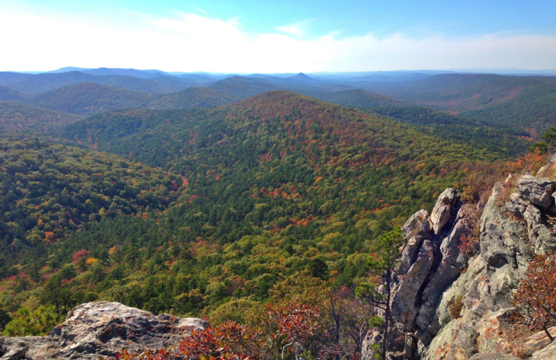
5. Ouachita Mountains
In the state’s far southeast, we have the Ouachita Mountains, a series of folded ridges covered in forests. Much of the area is part of the Ouachita National Forest and features the 70-mile-long Talimena National Scenic Byway, which is best traversed in fall when the autumnal colors are ablaze. The Ouachita Mountains were once part of a massive chain connected to the Appalachians, but as Pangea broke apart, tectonic plates tugged at the new North American continent and separated the long time partners. No one knows if they miss each other or if they are happy with the arrangement.
6. Picher, Oklahoma
Look at the town of Picher from this satellite image. What do you think this is?
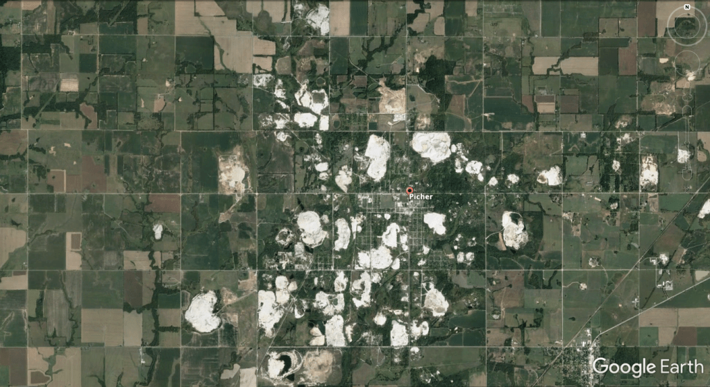
Sand dunes? Salt Plains? Crystal meth deposits? If you said mine tailings and a man-made environmental catastrophe, then CONGRATULATIONS, you are the winner!
Picher is a ghost town in far northeast Oklahoma that served as the area’s zinc and lead mining headquarters for more than 100 years. Decades of unrestricted subsurface mining left the ground unstable, and mountains of toxic mine tailings created a poisonous environment. Due to cave-in risks, groundwater contamination, and health effects associated with the tailing piles, the US Environmental Protection Agency declared it a superfund site in 1980.
In 1994, studies showed that 34% of the children in Picher suffered from lead poisoning and a 2006 survey determined that 86% of the buildings were in danger of collapse. People moved out of the city en masse; then as a final f-you, an F5 tornado demolished 150 homes and pushed most of the remaining residents out.
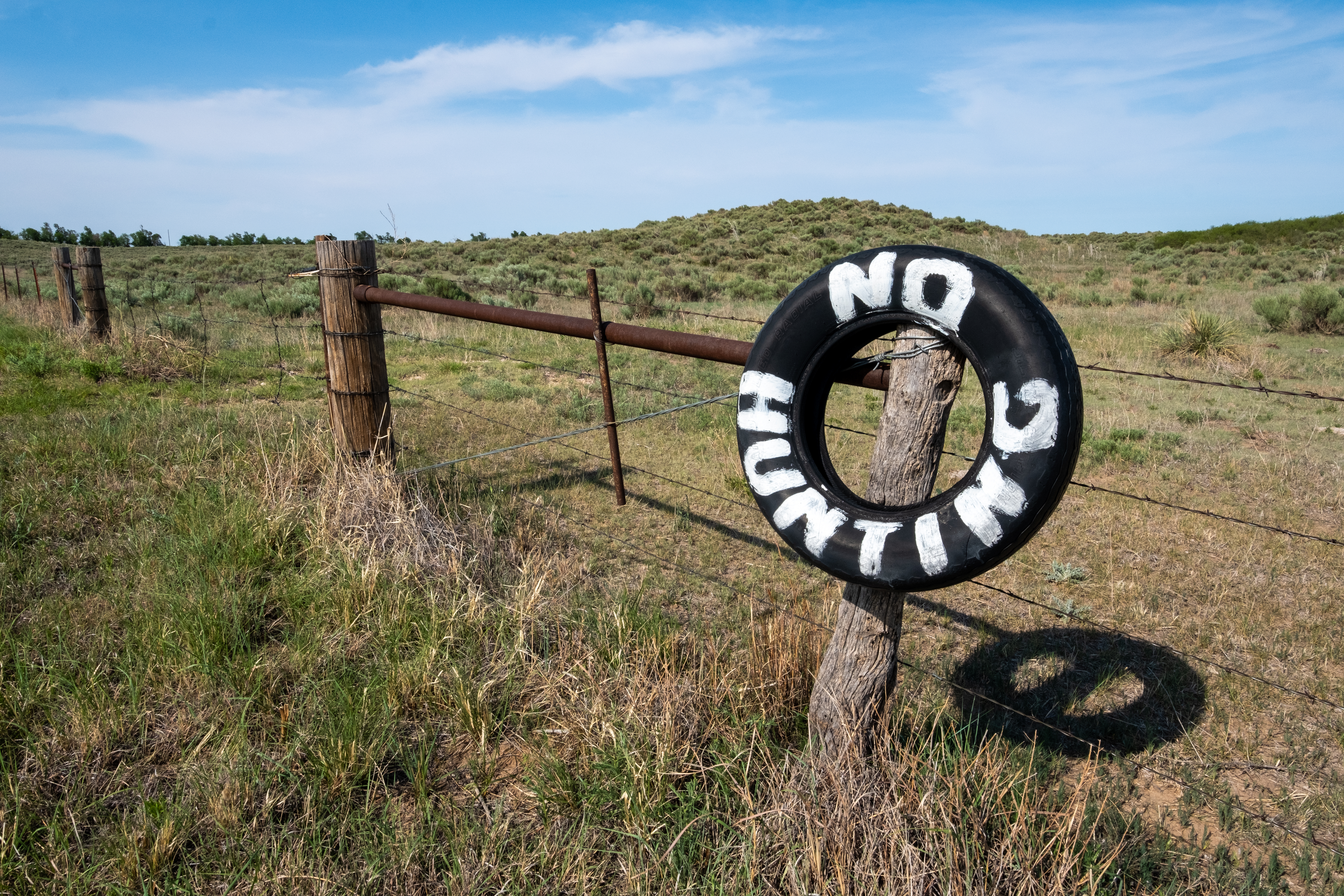
7. The Panhandle

All that talk of environmental destruction has got me down. Let’s talk about America’s racist history and how that led to the unusual state borders. Let’s travel back to 1820, eighty-seven years before Oklahoma became a state. As part of the Missouri Compromise, Congress prohibited slavery north of the 36th parallel. Texas, an independent country at the time, wanted to marry America, but there was one small problem – the chimney of Texas in the northwest part of the state extended to the 37th parallel.
In a rare act, Texas forfeited the land north of the 36th parallel and, in 1845, became the 22nd state. From 1845 to about 1890, Uncle Sam declared the orphaned strip of land that is Oklahoma’s Panhandle “No Man’s Land,” which we can all agree, is a badass name for a wild west territory.
Aside from the punk rock name, the land was indeed some man’s land for centuries, as nomadic Native American tribes had been living there for 10,000 years. But, I digress.
In 1886, Interior Secretary L. Q. C. Lamar declared the strip of land to be public domain and subject to “squatter’s rights” and thousands of white settlers flooded the area. In 1890 it became part of Oklahoma Territory, and in 1907, the state of Oklahoma.
The 100th and 103rd Meridians (The east and west borders of The Panhandle)
I always feel a sense of unease as I enter The Panhandle. I know that the plains extend thousands of miles in each direction, but somehow knowing that my state occupies a sliver of land 65 miles wide makes me feel hemmed in. I can’t explain it. I don’t have to produce a passport or procure a visa to enter Kansas or Texas. The world doesn’t end at the 36th or 37th Parallel or the 100th or 103rd Meridians, yet I feel somewhat confined.
Recently, I found out why I feel this way.
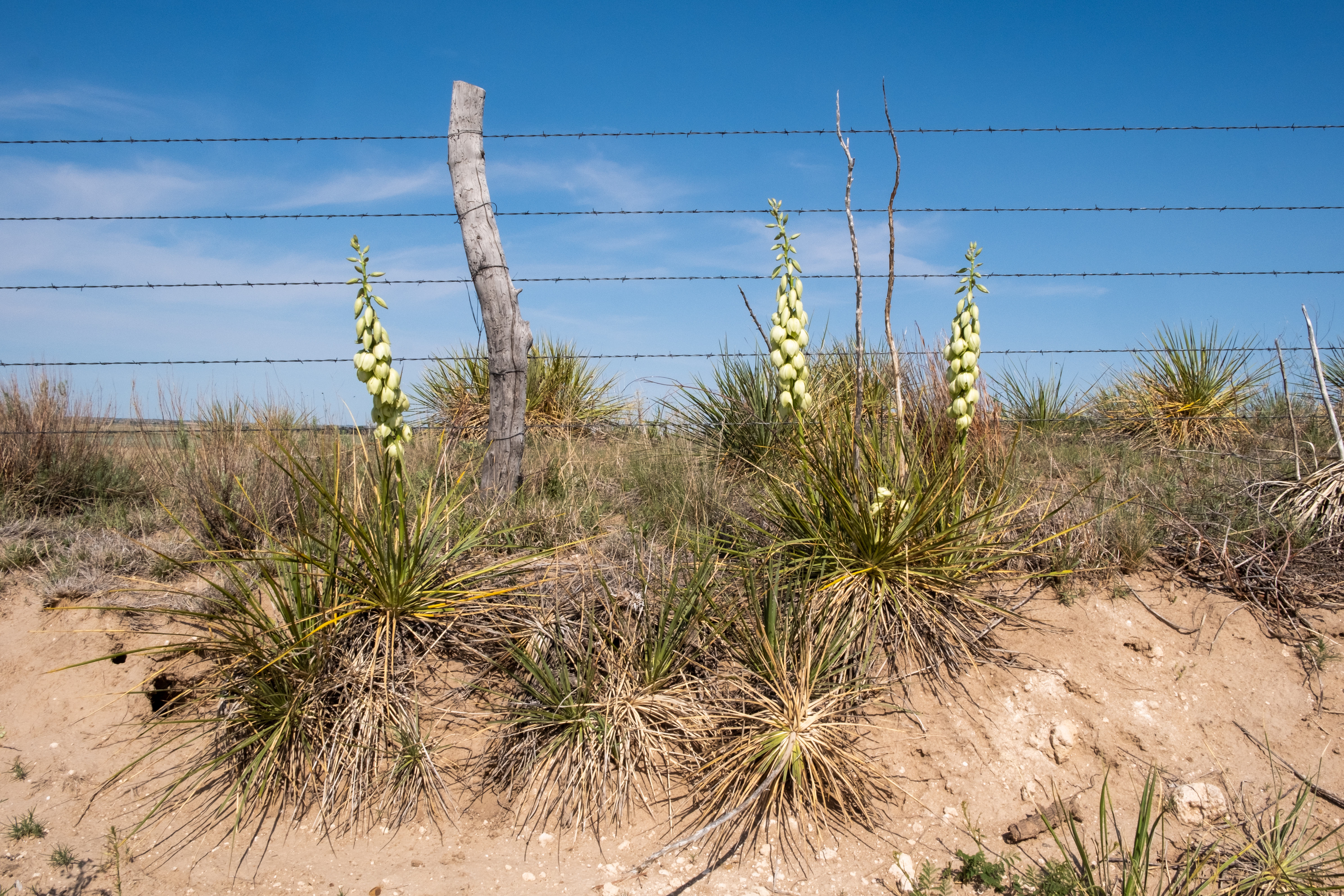
The eastern edge of the Panhandle, 40 miles from my hometown, is the 100th Meridian. This invisible line is the unofficial start of the High Plains, a geographic zone marked by decreased rainfall, slightly cooler temperatures, and marginally higher elevation that makes growing crops a challenge and water scarce compared to the fertile plains to the east. The Panhandle and High Plains are vast and empty spaces – and starkly beautiful. As soon as you drive into The Panhandle, the trees disappear, rolling sage-covered sandhills arrive, and the towns become few and far between. The Panhandle retains its frontier vibe long after its days as No Man’s Land.
The 103rd Meridian on the western edge of the state/panhandle also has a significant geographical distinction – it is the domain of Black Mesa, the highest point in the state at 4973 feet. The entire area is a maze of mesas and plateaus formed from ancient volcanic lava flows. The location marks the easternmost habitat for many plains animals and the westernmost habitat for many mountain species. For examples, the far western Panhandle is home to pronghorn, mule deer, bighorn sheep and mountain lions – fauna of the Rockies. In addition, bobcats, coyotes, nine species of snakes and 69 types of birds live in the area. And the humans that live there are territorial and hardy.


Three Corners
At the far northwestern tip of The Panhandle is three corners, the meeting point of Oklahoma, Colorado and New Mexico. Sharing an albeit small border with Colorado and New Mexico makes Oklahoma somewhat cool by association. Colorado is the hipster cousin that smokes ganja, skis in the winter, mountain bikes in the summer, and has an Obama poster on his wall. New Mexico is the trilingual uncle who spends winters in Mexico, plays in a folk band, and sells his artwork at festivals in the summer.
Oklahoma has a reputation as a flat, backward, fly-over state that is not worth visiting. As you can see, this reputation isn’t totally deserved because it does have some fascinating geography, stunning natural landscapes, and cool friends like Colorado and New Mexico.
_____________________________________
What are some geographic anomalies where you live?
Does Oklahoma have other anomalies that I missed?


I’ve been busted! Busted for thinking OK was unwavering in its flatness. You’ve opened my eyes to some beautiful and geologically interesting parts of your state. Nice article! Now, if you could research MN and write about its varying landscapes (if you can find any – haha), I’d be most appreciative.
Let me see what I can find in Minnesota. You do have lakes, marshland, the Great Lakes, and of course, tons of forest. Maybe I’ll make a post for you 🙂 Oklahoma is mostly flat but with these pockets of rugged geography that break up the monotony.
A guest post spot is waiting for you… 🙂
You will do very well in the classroom…love looking at our beautiful area of the world thru your eyes…thanks…
Thanks Jo. When I did my student teaching I definitely got the kids excited about Geography and Earth Science even though I probably failed teaching them anything useful in math 🙂
Jeff, the amount of knowledge you shared and I gained from your travels in Oklahoma is very much appreciated! I wish our Oklahoma History teacher in junior high had treated us to some of this! It would have made that class more interesting for sure. After living here for 72 years, I obviously have discovered some of this on my own. I have the knowledge of most of what you’ve written, but the way you write and present it is so very delightful and interesting to read! Thank you!
Thanks Debby. I really enjoyed my recent trip back home, especially driving on the open roads, hiking in the state parks, and visiting the small towns. It was nice to reconnect with those landscapes. I appreciate your comments.
Very interesting, Jeff. Thanks!
You are welcome. Thanks for reading.
So glad to read and look at this post. I have 3 remaining states to visit, and Oklahoma is one of them. You’ve given me several reasons to book a trip soon!
Three states left – you are so close! The Wichita Mountains are my favorite place. Black Mesa in the panhandle is beautiful, and Oklahoma City and Tulsa are actually nice cities to visit.
Not sure I’ll see these places, but they’re definitely worth the wait!
Gorgeous pictures Jeff. My sister lives in Texas’ panhandle so I really enjoyed reading your history a d geography lesson of it. Maggie
I like the Texas panhandle – it has a lot of rugged landscapes and old towns to see. Thanks for commenting!
Thank you Jeff for sharing the history and beauty of OK. I’ve driven through OK many times but missed most of the interesting facts and places you write about. Thank you for sharing. Now I know there is more to OK than the tornados the news media talks about!
There are more than tornadoes but those are still a big part of the experience! There aren’t many interesting sites along the interstates that cut through the state but on the backroads there are some unique places.
You’ve managed to put Oklahoma in a lot of people’s radar, Jeff. Rightfully so since it does look like an interesting state which is unfortunately better known for some less flattering stuff. A bit off the topic, are you still using your Fuji? Your photos look really crisp!
Yes, I’m still using my Fuji. I think I had a lot of clear, clean light in Oklahoma when taking photos. There isn’t a lot of pollution and we have like 300 days of sunshine, plus it isn’t near as visually cluttered as Asia, so I think my photos are simpler there.
Fascinating region
Yes it is.
And your post has educated me
Well this was an interesting read, and I drooled over your gorgeous photos of the Gloss Mountains. I knew nothing of OK except the song from the musical, and your comment about even if you were sick while travelling it was better than being in OK 😂 Where are you these days?
Alison
We moved to Taiwan two years ago. I need to write about it – maybe my next post. The Gloss Mountains are really cool – it is our version of the painted desert or badlands and has a wild west feel.
Right after your Wichita Mountains post, we decided to detour a bit and stop there on our drive from CO to TX. Alas, we got up that morning in Amarillo and saw that they would be halting any hiking that day at 10 am! The temperatures were extreme (well over 100), so we will have to try it again sometime. I’ve enjoyed all your OK posts. I’ve been to the Ouachitas and done a few other pass-throughs, but I’ve got to see that western stuff!
Wow! I never thought about them closing off the hiking trails due to heat but it makes sense. It does get very hot in the part of the state. Maybe next time! Did you see the Palo Duro Canyon if you were in the Amarillo area? Did you do any Route66 stuff?
We have hiked at Palo Duro! Very cool (and surprising) place. We will keep the Wichita Mountains in our heads since we do the TX-CO-TX trip often.
I admit that prior to reading your article I knew almost nothing about Oklahoma. I certainly had no idea about the diversity and beauty of the state. Gorgeous photos as always. The poor folks of Picher. That is really tragic on so many levels. A tornado like a final, horrific statement.
Thanks for sharing! I had no idea all of this was in Oklahoma. I had a friend tell me there was some beautiful camping in Oklahoma, but on our trips through the very flat part of Oklahoma, I thought that was all there was.
Hi Jeff – thanks for recommending the Great Salt Plains Lake State Park. We are currently here based on your recommendation and we are loving it.
Pingback: From Texas to The Great Salt Plains Lake State Park in Oklahoma – Retirement RV Dream